
Chester Bowl is an amazing place to Alpine Ski, Nordic Ski, hike, run, walk your on-leash dog, and bike! The park has over 6 miles of trails, not including the Alpine runs! Use these maps to plan your next adventure. The park contains 3 kilometers of Nordic ski trail, a 1.25 mile section of the Duluth Traverse (bike optimized multi-use trail), and a network of pedestrian trails in Upper Chester and on both sides of Chester Creek. Please note which trails can be used for which purposes, and respect other user groups on the trails. All dogs must be on leashes in Chester Park.
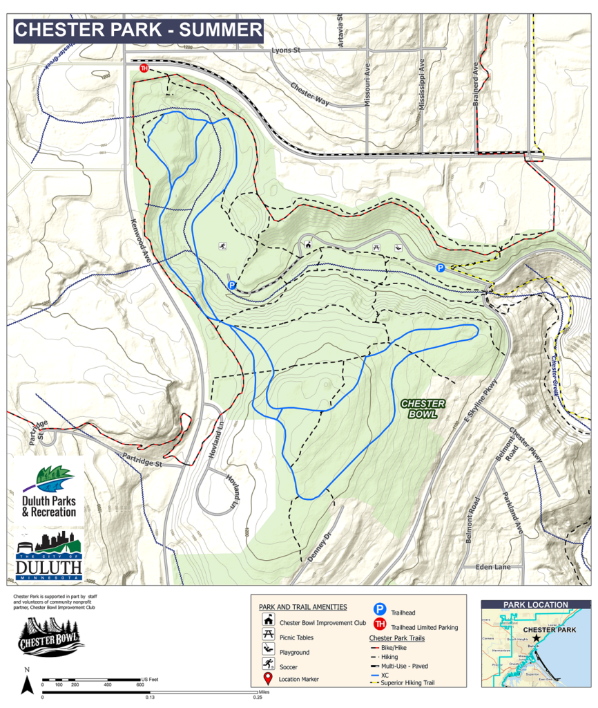
Find a higher resolution, printable, PDF of the summer map at this link.
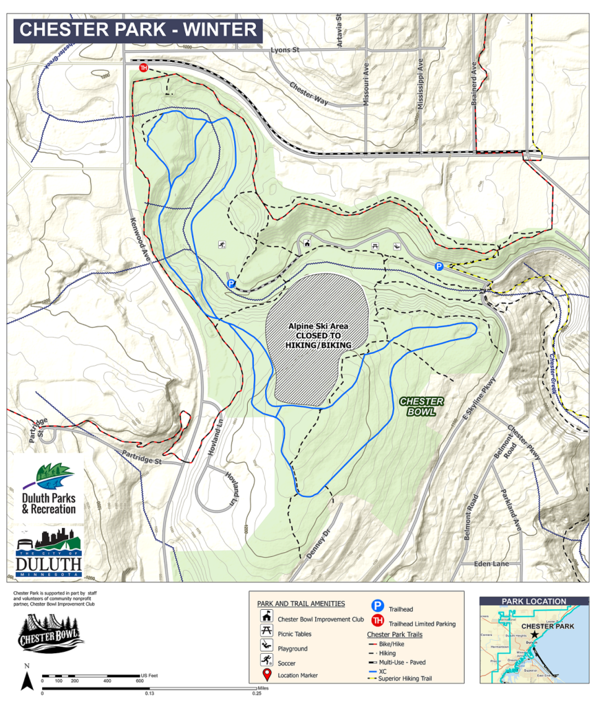
Find a higher resolution, printable, PDF of the winter map at this link.
Are you looking for a map of every trail in the City? Look no further! The Parks and Rec Department has produced the most awesome map ever! You can see the PDF version at this link, or an online interactive version at this link. Old school paper maps (our favorite option!) are also available for free at the Chalet, through the Parks Department, and at several local gear stores.